Sauble beach was a little too cool to stay and try the water so decided to go on down the eastern coast of Lake Huron to the village of Goderich. Once again we stayed at a nearby Provincial Park (Point Farms) although this one was a little tight for the motorhome. Goderich is billed "prettiest town in Ontario" and its hard to disagree. Its one of the larger ports for the lake freighters hauling salt and grain to the rest of the world. We were told that over two hundred boats are loaded out of this port every year. The pictures below were taken from the bluff above the lake where the town itself is located.

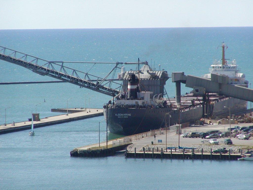
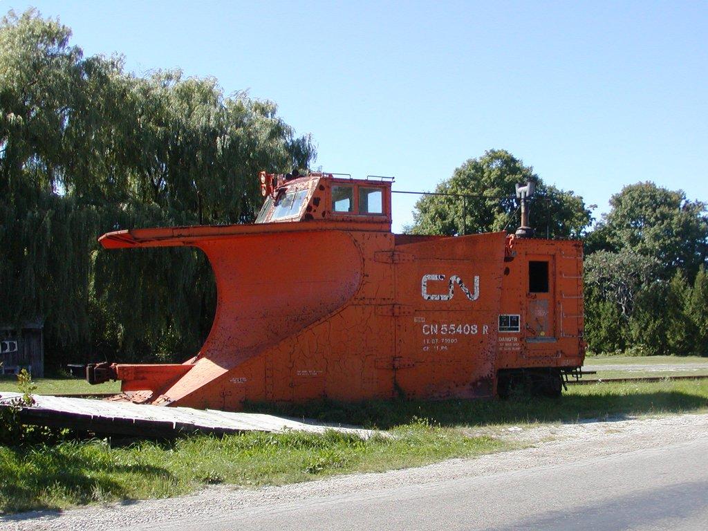
The docks were busy loading two freighters and we explored the nearby abandon rail station.....oboy railroad stuff.... which is a classic old brick structure with turrets. Spotted a rail snowplow (?) and we both walked the abandoned rail bridge across the river which was quite a view.

Unfortunately, we were so taken with the town and its beautiful hexaganal square and well kept downtown with a few outdoor resturants that we didn't take any pictures. It was just beautiful and truly a "pretty" town. Its like they should use it for a movie set. We had dinner at Baileys right on the square which was a family operation with truly good food. We will come back. We headed home the next day.
Friday, September 09, 2005
GODERICH, ONTARIO
Thursday, September 08, 2005
TOBERMORY TO SAUBLE BEACH AND FALLS
We landed at Tobermory and unfortunately hurried off the ferry intending to find a campsite and then explore. The place we had planned on staying however was a little to tight for our coach so we continued South to Sauble Falls Provincial Park. The provincial park system in Canada is fantastic, every park we have ever been in is as nice a campground as you will find and we both recommend using them. Sauble Falls and the Sauble River were not at their best however, as the water levels at this time of year are very low as evidenced in the picture below.

Sauble Beach was a surprise....its the Daytona Beach of Lake Huron with a regular highway 5-10 Kilometers that can be parked on and during season is obviously one crowded place. The day we visited there were only a few swimmers but the view along the shore when we drove from one end to the other was fantastic. The town is a typical summer beach town with lots of vacation cottages and private campgrounds and with that beautiful beach very much worth a stop again.
SAULT STE MARIE TO MANITOULIN ISLAND
We left the Mackinac Straits for the St Mary's River and the "Soo" as most call Sault Ste Marie on our trip around Lake Huron. Crossing the bridge over the St Mary's River we had quite a view of the locks and other items of interest among which are the rapids that are known for the Pink and King Salmon spawning runs each year. The first picture shows primarily the locks with a ship waiting to come upstream into Lake Superior. The second picture shows the power house, some of the original rapids and even a cruise ship in the upper left.

We left the "Soo" and proceeded East to Manitoulin Island which was a pleasant drive on a good two lane road. I have to say that Canadian drivers are very polite and it's kind of nice to slow to 70 KM/HR (approx 50MPH)and have a little time to see the country side. Crossing to Manitoulin Island was neat in that the swing bridge was somewhat old with a wooden deck and I was a little worried about our weight (17 tons) going across. The day was a bit hazy and frankly there is not much on the island at all, but looking out over a hazy Georgian Bay was pleasant. One other thing we noticed is the lack of people in the area...it is still the north country.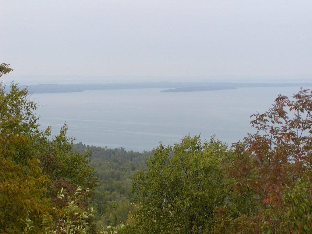
We were unable to reserve our spot on the ferry from South Bay to Tobermory as the young lady at the tourist info center didn't quite know what to do about charging for motorhome and tow vehicle so we just continued down to South Bay and found a campground right on the water. The view from our campsite at dusk was awesome.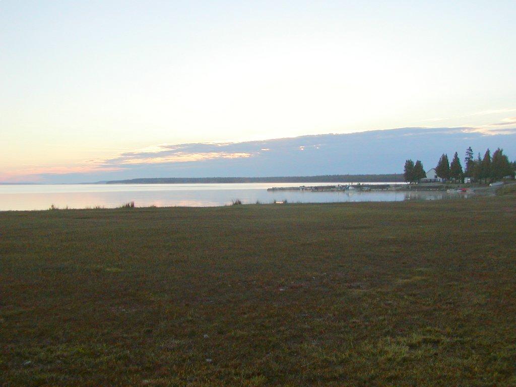
After settling in and having a super over portioned dinner with some homemade ala mode blueberry pie from a small mom & pop establishment, we found that we have to be in line for the ferry first thing in the morning in order to be sure to have a place. The morning brought bright sunshine and a beautiful day. Below is picture of some of the shoreline.
After waiting for couple of hours the Chi Cheemaun Ferry arrived and off loaded its vehicles while we waited to load.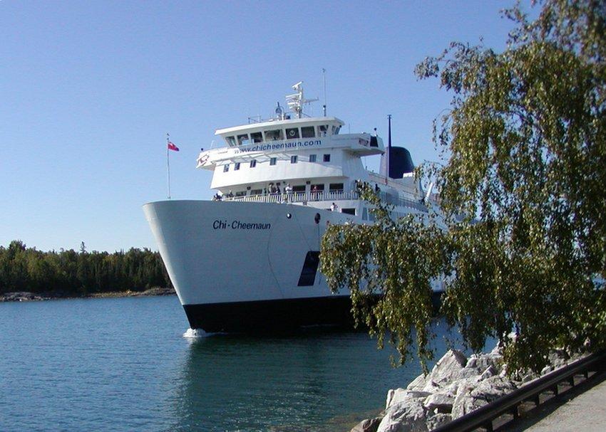
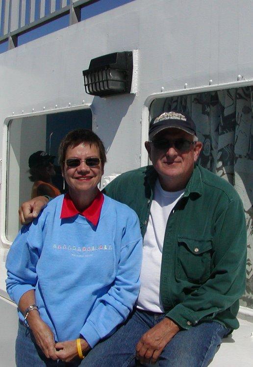
The trip is not quite two hours but the ship is quite large as it can carry 150 cars and trucks without problem. It has a full resturant and lounge along with deck areas to take in the sites of Georgan Bay. We spent amost all of our time on deck except to partake of a good lunch served on board.
Just a few shots to show you the scenery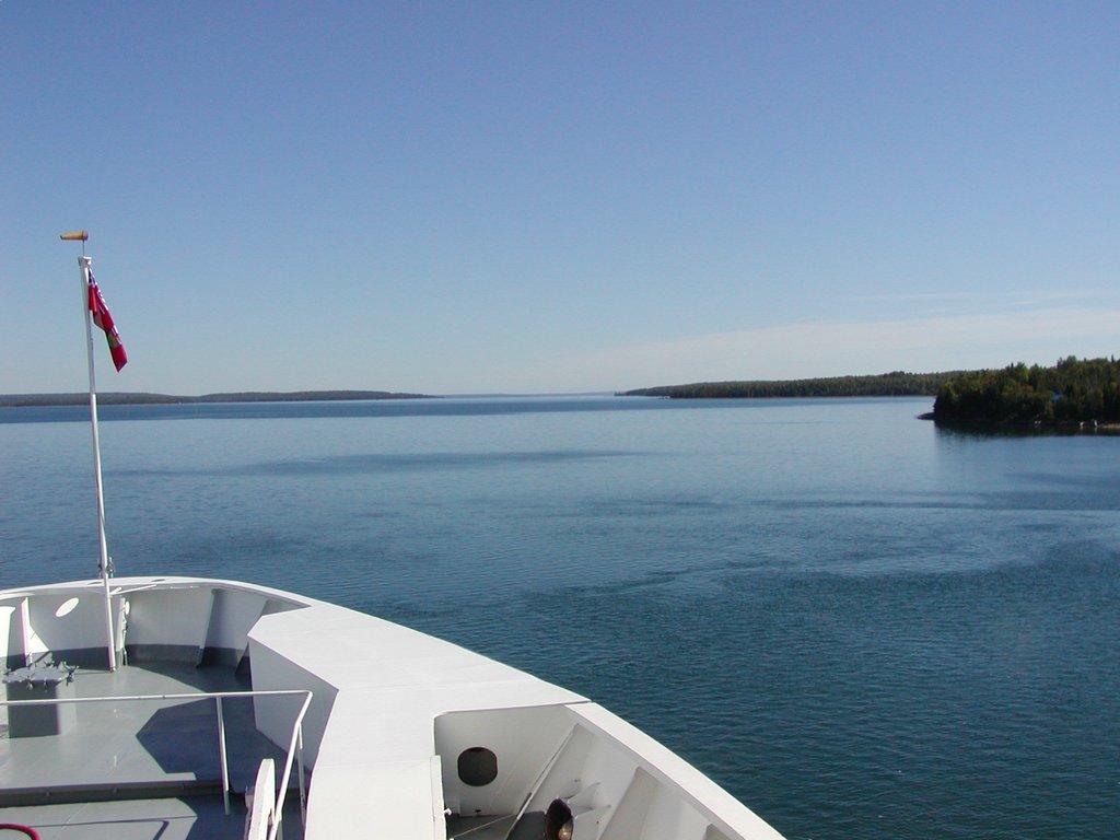

Although traveling in a motorhome and pulling a vehicle behind is a tad expensive relative to crossing the bay on a ferry, I would recommend the trip to anyone traveling in the area. Our day was all sunshine and the views will never be forgotten.
Wednesday, September 07, 2005
MACKINAC BRIDGE AND ISLAND
After leaving our friends at the Manistee river we ventured north to the Mackinac Straits, crossed the Mackinac bridge....
and enjoyed the view even with the height. Its quite thrilling to view the straits area from the bridge with freighters regularly plying the waters under it, particular from the seats of a motorhome that has direct line of sight over the edge. 
After crossing the bridge we went on to stay at a quiet National Forest Campground on the Carp River just north of the straits. The campground has 30 or so sights that are roomy enough for a bigger rig but there is no power or sewage dump. The campsights sit atop a ridge over looking the river itself and is a beautiful place.
We spent a couple of nights there and the days visiting Historic Mackinac Island.
The pictures below show the approach by ferry to the island with the Grand Hotel in the distance and also the old lighthouse at the entrance to harbor.

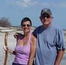
Once on the island there is horse transportation or bike which we just happened to bring with us. Check us out with our protective gear even!
One of the pleasures of Mackinac Island is the lack of vehicles. It is so nice to see a downtown area with just people walking and bikes at the side of the road "parked" instead of a multitude of cars.

An interesting sideline to our trip to the island was the sight of this young woman in wedding gown walking down the street with her mother stopping every so often and having pictures taken by a photographer. Turns out she was on her way to the beach where we were all witness to her marriage ceremony on the beach with the Mackinac Bridge in the background. Actually quite nice and everyone clapped as they kissed.

The island itself certainly lent itself to the "Somewhere in Time" movie and is a beautiful place one step away from the modern world, but it is also very touristy and we missed most of the crowd going after Labor Day. We didn't visit all the sights as we had seen some before and we will go back again...maybe with the grandkids.